One of the most common questions we get is regarding the elevation of various points along the Kern River. These are listed below as well as some interesting facts.

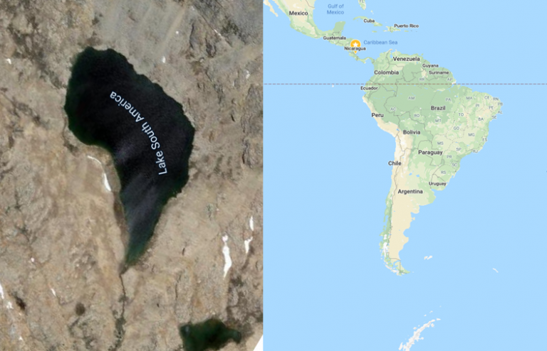
The Kern River starts at Lake South America, which is located at an elevation of 11,941 feet. The end of the Kern River is debatable, which I go into here, but generally speaking, this elevation is 404 feet (Bakersfield, CA). This means that the river drops a total of 11,537 feet, giving us an average gradient of 70 feet per mile. Keep in mind that this is a poor calculation in regards to river rafting on the Kern, as recreation happens on just a small fraction of its entire length. However, in this case, that average gradient of 70 feet per mile is pretty close to accurate for our Forks of the Kern rafting trips.
Mount Whitney – 14,505 Feet: Mount Whitney is the tallest peak in the contiguous United States. It is not considered the headwaters (starting point) of the Kern River, but snow that lands on it does end up in the Kern River drainage.
Lake South America – 11,941 Feet: Located just northwest of Mount Whitney, Lake South America is considered the headwaters of the Kern River.
Dome Rock – 7,221 Feet: The easiest ‘hike’ on the Kern River with some of the best views.
Forks of the Kern trailhead – 5,830 Feet: Guides and guests hike down to the river from here while on our Forks of the Kern Class-V trip. And when we say hike ‘down’ to the river, we truly mean down, losing 1,145 feet in just a few miles.
Forks Island – 4,685 feet: The Forks Island is where we put-in for our Forks of the Kern rafting trips. This is our highest elevation of where we start rafting. What this means is by the time we push off from shore, the Kern River has already fallen nearly 70% of its total altitude.
Durrwood Camp – 4,343 feet: This is a popular camp for boaters on the Forks. Guides learn to memorize this elevation because “Camp” has four letters in it and “Durrwood” has three double letters. So it’s four three double, 4343.
Metamorphosis Rapid – 4,000 feet: The GPS gave me 3,999 but I’m going to round up in this instance.
Carson Falls – 3,822 feet: The final Class-V rapid on the Forks of the Kern and also one of the biggest.
Johnsondale Bridge – 3,763 feet: This is the furthest upstream put-in for the Upper Kern and is the beginning of the Limestone section.
Hospital Rock Rapid – 2,975 feet: This is the closest feature to 3,000 feet on the Upper Kern.
Riverkern, CA – 2,795 feet: Small town just upriver from Kernville, CA.
Kernville, CA – 2,667 feet: Whitewater Capital, USA.
Wofford Heights, CA – 2,684 feet: Our trips meet and end here at our Rafting Center.
Slippery Rock – 2,460 feet: The most upstream put-in for the Lower Kern.
Kern River Outfitters overnight camp – 2,217 feet: Our campground for our Two Day trips.
Sidewinder Rapid, Part B – 2,007 feet: This is the closest feature to 2,000 feet on the Lower Kern.
Democrat take out – 1,952 feet: The take out for our overnight rafting trips.
